


The Growing Risk for Cities and Counties
Across the country, cities and counties are facing an escalating series of climate-related events that are no longer isolated or rare — they are becoming part of normal operations.
Extreme rainfall, flooding, heat waves, wildfires, and storms now disrupt not only infrastructure but also community safety, local economies, and city budgets.
These risks impact:
-
Public safety – flooded roads, heat emergencies, power outages
-
City operations – damaged infrastructure, disrupted services, increased maintenance costs
-
Community well-being – vulnerable residents at higher risk, increased health impacts, reduced quality of life
-
Economic stability – property losses, business interruptions, insurance costs
Resilience starts with understanding risk — and managing data that helps you act faster and plan smarter.
The Growing Risk for Cities and Counties
Across the country, cities and counties are facing an escalating series of climate-related events that are no longer isolated or rare - they are becoming part of normal operations.
Extreme rainfall, flooding, heat waves, wildfires, and storms now disrupt not only infrastructure but also community safety, local economies, and city budgets.
These risks impact:
-
Public safety – flooded roads, heat emergencies, power outages
-
City operations – damaged infrastructure, disrupted services, increased maintenance costs
-
Community well-being – vulnerable residents at higher risk, increased health impacts, reduced quality of life
-
Economic stability – property losses, business interruptions, insurance costs
Resilience starts with understanding risk — and managing data that helps you act faster and plan smarter.

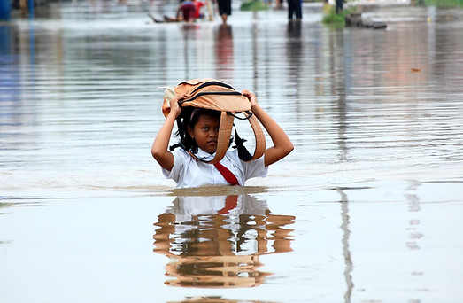
The Realities Cities Are Confronting
Flooding
-
Heavier rainfall events overwhelm drainage systems not designed for today’s climate.
-
Road closures delay emergency response and disrupt businesses.
-
Repetitive flooding degrades infrastructure and erodes public trust.
How Cloudsyte helps:
Flood Monitoring IoT sensors track real-time water levels and automatically create tasks for inspection and mitigation, helping cities identify chronic hotspots and prioritize drainage upgrades.


Heat Waves
-
Extreme heat is now the leading weather-related cause of death in many U.S. cities.
-
Heat islands in urban cores drive up energy use and strain vulnerable residents.
-
City operations—from outdoor work schedules to cooling center coordination—become harder to manage.
How Cloudsyte helps:
Through integrated data management, Cloudsyte can track heat risk metrics, map high-temperature zones, and align cooling and greening projects with vulnerable populations for smarter heat response planning.
Air Quality Events
-
Wildfire smoke and vehicle emissions degrade air quality even hundreds of miles away.
-
Sensitive populations—children, elderly, those with respiratory illness—suffer first and most.
-
Lack of localized monitoring leaves cities without actionable data.
How Cloudsyte helps:
The Cloudsyte Air Monitoring IoT network enables cities to deploy small, connected sensors for real-time visibility, helping local agencies trigger alerts, evaluate patterns, and communicate risk effectively.
Drought and Water Stress
-
Declining rainfall and increased demand threaten local water supply reliability.
-
Utilities face pressure to balance conservation targets and service delivery.
-
Communities experience increased costs and vulnerability to shortages.
How Cloudsyte helps:
Cloudsyte’s platform can track water usage data, visualize consumption trends, and support coordinated conservation planning through integrated analytics and reporting.
Storms & Infrastructure Resilience
-
Hurricanes and severe weather events damage assets, disrupt power and transportation, and lead to significant recovery costs.
-
Infrastructure resilience is often reactive instead of planned and tracked.
How Cloudsyte helps:
Cloudsyte centralizes resilience data—assets, projects, and funding—helping cities plan, monitor, and report on long-term recovery and adaptation projects.
The Hidden Cost of Fragmented Data
Even the most well-prepared municipalities struggle to manage risk when data lives in separate systems or spreadsheets.
When a storm hits or temperatures spike:
-
Operations teams lack real-time situational awareness
-
Departments rely on manual updates
-
Decision-makers get incomplete information
-
Communities receive slow or inconsistent communication
Cloudsyte solves this by creating a single source of truth — connecting data from multiple systems into one shared, real-time platform for resilience management.

Resilience Is Not a Project - It’s a System
Resilience isn’t built in one grant cycle or through a single plan.
It’s achieved when data, departments, and communities are connected and informed.
Cloudsyte empowers cities and counties to:
-
Anticipate risks before they escalate
-
Coordinate faster during emergencies
-
Prioritize infrastructure and budget decisions
-
Show measurable progress toward resilience goals